Best Sight Seeings:

Showing posts with label Caribbean. Show all posts

Thursday, December 10, 2009

Aruba "An undying faith in the power of beaches, turqoise waters and the bright Caribbean sun"

Formerly part of the Netherlands Antilles, Aruba lies just north of Venezuela amongst a splash of Caribbean waters. Since its gold and oil industries have both come to a halt, Arubans have turned to tourism with a seemingly undying faith in the power of beaches, turqoise waters and the bright Caribbean sun to draw visitors. So far, their faith has been rewarded with large tourist numbers. Aruba's beaches are reportedly the best in the Netherlands Antilles; unfortunately, this translates into packed sands, making a private holiday experience in Aruba something of a fib. But for many travellers, the large numbers of tourists have actually been an added bonus, granting the island an energetic party vibe. For them, the chance to get down and dance to Caribbean music is enough to make this a destination they will come back to year after year.

Aruba is a 33-kilometre (21 mi)-long island of the Lesser Antilles in the southern Caribbean Sea, 27 kilometres (17 mi) north of the Paraguaná Peninsula, Falcón State, Venezuela. Together with Bonaire and Curaçao, it forms a group referred to as the ABC islands of the Leeward Antilles, the southern island chain of the Lesser Antilles.

An autonomous region within the Kingdom of the Netherlands, Aruba has no administrative subdivisions. Unlike much of the Caribbean region, Aruba has a dry climate and an arid, cactus-strewn landscape. This climate has helped tourism as visitors to the island can reliably expect warm, sunny weather. It has a land area of 193 square kilometres (75 sq mi) and lies outside the hurricane belt.

Eagle Beach

Eagle Beach is a beach and neighborhood of Oranjestad, Aruba. The neighborhood is famous for its many low-rise resorts and wide public beach. It has soft white sand and has been rated one of the best beaches in the world.

Palm Beach

Palm Beach, Aruba is a city northwest of Oranjestad, capital of Aruba, and is home to the high rise hotels and a new shopping district that would be finished in 2009. Since the boom in the tourism industry several five-star hotels have opened in the area and some upscale malls and shopping centers have been developed as well with at least two being scheduled for opening in late 2009 or early 2010.

Multiple time-share ownership and full-time ownership condos have been or are being built in the area as well.


Boca Prins

Boca Prins are massive sand dunes, constantly changing because of the trade winds. 'Dune sliding' is a popular sport. The dunes lie behind a narrow stretch of beach along the coast.

Boca Mahos

Boca Mahos is a bay known for its strong winds and rough waters. 1km/0.6mi west of the bay is a ruined inn.

Malmok

Malmok is a small settlement with a pleasant beach. This is a favorite spot for swimming and snorkeling with calm waters much of the time. The wreck of the German freighter "Antilia," run aground at the beginning of WWII, lies just offshore.
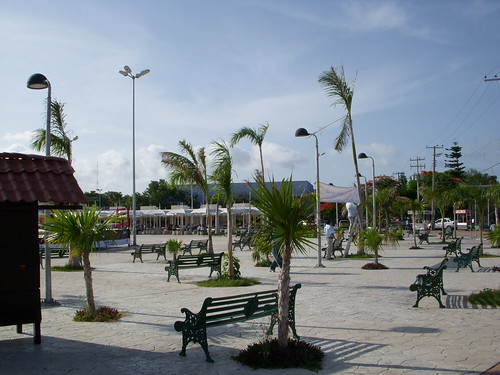
Oranjestad

Oranjestad is the capital of Aruba. The older buildings are in Dutch Colonial style, but the Spanish influence of balconies and gardens, and the Caribbean influence of bright colors makes them unique to The Netherlands Antilles.
The city has many historic sites and museums, as well as gardens and a busy shopping street.

Archaeological Museum of Aruba
The Aruba Archaeological Museum closed temporarily to the public while relocating to a historic complex.

Atlantis Submarine

The Atlantis Submarine takes visitors on a tour through the Barcadera reef to see the marine life, coral formations, and ship wrecks. Although the tour is just under two hours long, guests spend only 45 minutes in the submarine.

Butterfly Farm

The Butterfly Farm in Oranjestad houses butterflies from around the world in an enclosed tropical garden. Displays at the site illustrate each stage of a butterfly's development from larva to adult.

Floating Market
(Local Name: Schooner Markt) From their boats, merchants sell Venezuelan fish, fruits, vegetables and spices along the dock.

Fort Zoutman and King Willem III Tower

The King Willem III Tower stands at Fort Zoutman. It was built as a lighthouse and to sight pirates. On Tuesday evenings from May to December the Bon Bini Festival welcomes guests to enjoy Aruban cuisine and entertainment.

The King Willem III Tower also houses the Historical Museum.

Strea Charters


Strea Charters offers cruises and snorkeling excursions out of Oranjestad. A typical trip involves a morning sightseeing cruise with stops for snorkeling, along with a lunch. The company also offers private charters with a captain and crew.

Wilhelmina Park

The park is best seen in June, September or October when the tropical foliage is in bloom. The park was created in 1955 in honor of Queen Juliana and Prince Bernhard of the Netherlands. There is also a marble sculpture of Wilhelmina, the queen mother, created by Arnoldo Lualdi of Italy.


Alto Vista Chapel

The small Alto Vista Chapel, sometimes called the Pilgrim's Church, was built in 1750 by the Spanish missionary Domingo Antonio Silvestre. The stations of the cross mark the road leading to the chapel.

Aruba Ostrich Farm


The Aruba Ostrich Farm is home to both ostriches and emus. Visitors can tour the farm and get up close and personal with the birds while learning about their habitat and behavior. There is also a gift shop with African art and restaurant on site.

Ayo

Large boulders adorned with Indian paintings make up this odd rock formation known as Ayó. There is a path for visitors to get around and see the rocks.

Natural Bridge at Anicouri

The 30m/100ft natural bridge stands 7.3m/25ft above sea level. Wave erosion caused the formation of this structure. The area is good for a picnic, but swimming is not recommended.

Casibari Boulders
Diorite boulders weathered by trade winds are strewn throughout this area. At the Casibari Boulders visitors may walk the trails and steps winding through the rocks to reach a good view at the top.

Bushiribana


The Bushiribana Ruins are the remains of a 19th C gold smelter. The old stone walls are picturesquely located along the ocean front.


Arikok National Park

The island's best preserved Indian carvings adorn the boulders at Cunuco Arikok near San Fuego. The park is an excellent hiking opportunity and has a small number of jeep routes. Wildlife includes parakeets, goats, butterflies, hares, iguanas, and wara-wara (read-beaked eagle).

Natural Pool

The Natural Pool is just that, a protected area, fenced in by rocks but filled by ocean water. Visitors can swim and snorkel here although the area is really not that big. The challenge comes with getting to the natural pool which is accessed by four wheel drive vehicle down a rough road. Visitors can either do this on their own, although the road is not well marked, or hire a guide.


North End of Aruba

The north end of Aruba is best for relaxation. Here is the seven mile stretch of white sandy beach, an 18 hole golf course and a concentration of hotels.

California Dunes and Lighthouse

At the northern tip of the island, is the California lighthouse, a common sight on postcards and brochures of Aruba. This area is rugged and beautiful with sand-dunes, cacti, and even some goats. The spot is a good place to compare the calm waters of the western shore with the rough waves of the east. The lighthouse is closed to the public.

Arashi Beach

Arashi Beach can be a good spot for swimming and snorkeling and is somewhat secluded. The beach is located at the northwestern end of the island near the California Lighthouse.

South End of Aruba
The south end of Aruba is good for sporting activities. The windward side gives ample challenge to the expert windsurfer, while the leeside offers protected bays for beginners. There are also good hiking routes to historic sites.

Hooiberg

Hooiberg is a cone shaped 'mountain' that stands alone in the center of the island and rises 165m/617ft above sea level. After climbing almost 600 steps to the peak, on clear days visitors are able to see the coast of Venezuela from the summit.

Seroe Colorado

At the east end of Aruba is Seroe, once occupied by oil refinery employees but now a ghost town. Today there is a lighthouse with views across the dry landscape, the beach, and the ocean beyond.

St Nicolaas
St Nicolaas is the second largest city in Aruba. It has been home to the oil refinery since 1929.

Amerindian Caves
These Amerindian Caves were once the dwellings of the Arawak Indians and Caribs. Some caves contain pre-Columbian petroglyphs, stalagmites and stalactites. Nearby is a Chinese garden, as well as a small museum with native wildlife.

Balashi
This is the site of the 19th C gold mining industry. Nearby, at Frenchman's Pass, are the ruins of the old gold smelters.

The neo-gothic St Anna Church
The neo-gothic St Anna Church was opened in 1776. The carved oak altar, originally made for a church in Curaçao, was mistakenly sent to St Anna. The parish kept the altar, but needed to cut church's roof to accommodate it. The tombs in the neighboring cemetery have been painted pastel colors.

Rancho Daimari

Rancho Daimari offers horseback riding tours, ATV tours, and Paint Ball games. The ranch is located on the site of a former coconut plantation, originally established in the 17th Century. The scenery here is beautiful and visitors can explore the area either on horse or ATV.

Transportation

By Plane

Flights arrive and depart at Queen Beatrix International Airport (UAU). Aruban based Tiara AirCuracao, Bonaire and Punto Fijo in Venezuela. Many other airlines serve Aruba from several countries in both North America and Europe. Martinair and KLM have direct flights from the Netherlands, while Condor flies there directly from Frankfurt. Air CanadaToronto, while a number of United States based airlines have flights to cities like Miami and New York. Aruba is well connected with neighbouring islands and countries like Suriname, Dominican Republic and Colombia. has flights from Aruba to has flights to and from

By Boat

Apart from flying, your only options are to get there by boat. Unfortunately there are no (more) ferry services between Aruba and any other island in the Netherlands Antilles, nor is there any connection with other countries like Venezuela, although there used to be services to both. Yacht and cruise (and maybe cargo) ships are your only option really.

Getting Around

By Plane

Apart from some helicopter services, there are no options of getting around the island through the air.

By Car

Aruba is a perfect island to explore on your own by car. Roads are generally in good condition and there are a dozen or so of international and local car rental agencies located in the airport, Oranjestad or one of the biggers hotels. Your national driver's licence is valid on Aruba, but you have to be 21 years of age (sometimes even 25, and there is a maximum age of 65 to 70) to rent a car. Driving is on the right side of the road.

By Bus

Arubus is a local busline company which has inexpensive, comfortable and reliable transport to some parts of the island, except the most northern parts and the interior, where you really need your own wheels. The main route runs from San Nicolas to Oranjestad and the major hotels along the beach on the north-west coast. Prices start at around $2 return tickets and make sure you have the right change before you board. The buses run each half hour from Monday to Saturday 6 a.m. until 6 p.m. They also run on Sunday running each hour.

For other destinations, you can arrange a taxi which has fixed rates (Aruba has taxi zones, so you can calculate your price). Some drivers double as guides if you like.

By Boat

The only regular passenger services are ferries departing daily to De Palm Island from the mainland. Crossings run every half an hour between 9 am and 6 pm.


Saturday, April 18, 2009

Cancun "Mexican Caribbean"


Cancún, on the Yucatán Peninsula. Cancun is located on the Yucatan Channel that separates Mexico from the island of Cuba in the Greater Antilles. The Cancun region is sometimes known as the Mexican Caribbean.
Cancun is the municipal seat of the Benito Juárez municipality and a world-renowned tourist resort. The city centre is located on the mainland which connects the Nichupté and Bojórquez lagoons to a narrow "7" shaped island where the modern beachfront hotels are located. The island of Isla Mujeres is located off the coast and is accessible by boat from Puerto Juarez.

Isla Mujeres Turtle Farm

Several species of sea turtle lay eggs in the sand along the island's calm western shore. Although they are officially an endangered species, sea turtles are still killed throughout Latin America for their eggs and meat, which are considered a delicacy. In the 1980s efforts by a local fisherman led to the founding of Isla Mujeres Tortugranja, which protects the turtles' breeding grounds and places wire cages around their eggs to protect against predators.
Hatchlings live in three large pools for up to a year, at which time they are tagged for monitoring and released. Because most turtles in the wild die within their first few months, the practice of guarding them until they are a year old greatly increases their chances of survival. The Turtle Farm is a scientific facility, not an amusement centre. But if you'd like to see several hundred sea turtles, ranging in weight from 150g (5oz) to more than 300kg (661lb), this is the place for you.


Mayan Temple


Dedicated chiefly to Ixchel, Maya goddess of the moon and fertility, this temple was 'discovered' by Francisco Hernández de Córdoba's expedition in 1517. The conquistadors found various clay female figures here; whether they were all likenesses of Ixchel or instead represented several goddesses is unclear. In 1988, Hurricane Gilbert almost completely destroyed the ruins.

Park Las Palapas

Park Las Palapas is quiet and safe, a great place for an afternoon picnic or an evening stroll.

Playa Delfines

Delfines is about the only beach with a public car park; unfortunately, its sand is coarser and darker than the exquisite fine sand of the more northerly beaches. On the upside, the beach has great views, there are some nearby Maya Ruins to check out and, as the last beach along the boulevard, it is rarely crowded. Heed the signs regarding swimming conditions as undertows are common here.

Playa Langosta

In the middle of the north end of Zona Hotelera, Playa Langosta is a gem of a place for swimming. Facing Bahía de Mujeres, the beach is coated with Cancún's signature powdered coral sand and the waters are quite shallow, making it good for snorkeling. If you've had enough of the water there are lots of beach restaurants and bars.

Plaza Las Américas

Plaza Las Américas at the south edge of the centro, is a vast modern shopping mall that includes the Liverpool and Chedraui department stores, a multiplex cinema, a food court and a salsa dance club. Don't confuse it with Plaza América, a small, aging arcade on Avenida Cobá with a few airline offices.

Puerto Juárez

Puerto Juárez is the main port for passenger ferries to Isla Mujeres. Punta Sam, the dock for the slower car ferries to Isla Mujeres, is about 7km north of downtown. Irregular services leave from the Zona Hotelera.

Yamil Lu'um

There are two sets of Maya ruins in the Zona Hotelera. The smaller site is Yamil Lu'um, where only the outward-sloping remains of the weathered temple's walls still stand; however, the ruin is still worth a visit, as much for its lovely setting as anything else.
To reach the site visitors must pass through either of the hotels flanking it or approach it from the beach - there is no direct access from the boulevard.
The tiny Maya structure and chac-mool statue on the beautifully kept grounds of the Sheraton Hotel are authentic and were found on the spot.

Zona Arqueológica El Rey

There are two sets of Maya ruins in the Zona Hotelera and, though neither is particularly impressive, both are worth a look if time permits. The first is the Zona Arqueológica El Rey, on the west side of Blvd Kukulcán between Km 17 and Km 18, there's a small temple and several ceremonial platforms. The other, much smaller, site is Yamil Lu'um.

Transportation
Bus, Local
PRICE 6 pesos (about 60 us cents)
Bus stops are marked "Parada" and show a picture of a bus. All busses marked "Hoteles R1" go on a circle route from the Hotel Zone and along Av. Tulum to the Crucero. Those marked R2 or R15 go to Wal-Mart. All other busses are a complete mystery that will not be solved by vacationing gringos. Service is quite frequent. During the evening rush hours, crowded busses will sometimes pass without stopping, often because they are on special contract transporting workers for some hotel or construction company.

Bus, out-of-town
The best way to go on day trips outside of Cancun as far as Tulum or Chichén-Itzá is to take one of the busses that leave from the central bus station downtown near the second traffic circle. Just try your best to understand the system, as we never quite got the gist of it in some two years of commuting from Puerto Morelos to Cancun. You buy your ticket at either of the two sets of windows representing the different lines.
The difference between first and second class busses is not immediately distinguishable, except there is reserved seating on first class long distance routes. Get to the bus station as early as possible in the morning and make sure that you know what time the last bus in the return direction leaves.
There is also luxury bus service to and from Mérida that is well worth the extra charge and is actually more convenient than going by air. Consult any travel agent.

Taxis
We defy death here to tell the truth about the taxi situation in Cancun. That is the exact and literal truth and may God strike us down with a thunderbolt if we lie. An informed source told us that the publisher of a leading tourist guide here was threatened with death for printing the official prices of taxi service in Cancun. Each taxi driver feels free to set his own rates, which are determined by secret consensus. You're supposed to know when the price has changed, even if it hasn't.

Thursday, March 12, 2009

Visit to Corn Island (Khueny Tips)

Used to be the British buccaneers (and still a frequent stopover for Colombia-based pirates), Big and Little Corn Islands are now low-key vacation spots in an isolated corner of the Caribbean. The two Islas del Maíz retain in many ways the magic associated with the Caribbean - clear turquoise water, white sandy beaches fringed with coconut palms, excellent fishing, phenomenal coral reefs to explore and an unhurried, peaceful pace, as yet uncluttered with Cancún-style resorts. Little Corn in particular lives up to this elusive image. Christopher Colón breezed through in 1502, but it wasn't until 1660, when a French pirate by the name of Jean David Nau arrived, that continuous contact was made with the local Kukras-Mayangna Indians. In the 1700s British pirates and African slaves arrived, and both groups mingled with the Kukras. Although the British were asked to leave the islands in 1786, as part of a treaty with the Spanish, they returned in 1841 after independence from Spain; an event still celebrated after August 27 with crab soup and dancing. Many Miskito Indians from the nearby "Miskito Coast" as well as Nicaraguans from the "mainland" have moved to Big Corn Island in recent years,diversifying the population and languages overheard on the island. Still, the laid back atmosphere and lifestyle seems to
overtake anyone who visits The Corn Islands. The tourism and hospitality industry is in its infancy! Here you can still get a room for less than $10 in a family run hospedaje and buy an excellent dinner from street vendors for $1.50. The local beer is always cold and you buy rum by the bottle at the restaurants. Adventure travelers seek out The Corn Islands for their fishing (flats and offshore), scuba diving and snorkeling.

The Corn Islands are surrounded by a barrier reef system which is a unique underwater ecosystem for snorkeling and scuba diving. Whether snorkeling from the beach or on a dive excursion with one of the local dive operators, one can expect to see a wide variety of corals, sponges, tropical fish, rays, schools of snapper, turtles and even dolphin. Don't miss the famous "Blowing Rock" which is a rock/coral formation teaming with marine life, which climbs from the sea floor, 100 feet below, until it broaches the ocean surface. Divers see a mix of tropical fish as well as larger offshore species including barracuda, mackerel, jacks, pompano & shark. Those who have never scuba dived before can take advantage of a "discover scuba" course for a one time scuba experience or enroll in a PADI dive certification course which can be completed in 3-4 days.


Transportation

Air
Many major airlines fly into Managua, Nicaragua's capital city. After clearing customs and immigration, exit the terminal and walk to the left. Just a short walk to the end of the airport terminal, you will find a separate terminal building for the regional airlines which provide service to Bluefields, Big Corn Island and Puerto Cabezas. La Costena Airlines flies these routes with the last flights leaving Managua at 2:00 p.m. Round trip tickets to Big Corn Island cost approximately $165.00 USD. Reservations are required and can be made by emailing the owner at jcaballero@lacostena.com.ni Flight time to Big Corn Island is approximately 1 1/2 hours with one stop in Bluefields. Baggage is limited to 30 lbs per person. Once you land on Big Corn Island, claim your luggage and reconfirm your return flight. From here you can get a taxi anywhere on the island for 15 cordobas per person ($.95). Be firm about going to your desired/reserved hotel as many taxi drivers receive commissions for diverting visitors to particular hotels. To get to Little Corn Island, take a taxi to the Municipal Wharf in Brig Bay where you will find the water taxi waiting on the lower, wooden dock. The schedule for the water taxi to Little Corn is coordinated with flight arrival and departure times;

Big Corn - Little Corn at 10a & 4p
Little Corn - Big Corn at 7a & 2p


Travel time is 1/2 - 1 hour depending on weather. In the event that you must guarantee your connection with return flights, it is advisable to overnight on Big Corn Island.

For those who wish to do a "day trip" to Little Corn, without having to "overnight" on Little Corn Island, a new water taxi service, "Blandon," now offers departures:

Big Corn - Little Corn at 7a
Little Island - Big Corn at 4p.


Taxi
A taxi anywhere on the island (each stop) costs 15 cordoba per person (<$1.00) during the day and 20 at night. Corn Island's primary industry is fishing. Nicaragua's 3rd largest export is lobster, most of which is processed in Big Corn Island. Motorcycle
Motorcycle Rental: 2006 & 2007 Yamaha 125 with electric start. $30 per day, $100 security deposit.

Tourism
Take a visit to the 400 year old wreck of a Spanish Galleon by snorkel, dive or glass bottom boat excursion. The wreck lays in 15' of water off of Waula Point, Big Corn Island. Clearly visible are 14 cannons and the original anchor. No known archaeological survey or salvaging has ever been done on this wreck. Hike to the highest point "Mount Pleasant Tower" on Corn Island
through plantations and lush flora and view the 360 panorama of the island. Plan a Corn Island wedding or engagement ceremony officiated by the local judge, everything can be arranged by local hotel managements. "Soul of the World-Excavation", the culpture project by renowned artist, Rafael Trenor, located on Quinn Hill, Big Corn Island.

Google It:

Custom Search